NRECA International is using drones for the first time as it helps a government-owned electric utility in Bangladesh improve its efficiency and boost customer satisfaction.
Two drones are being deployed by NRECA International to help develop a geographic information system for the Northern Electricity Supply Co. Ltd. The distribution utility is based in Rajshahi, near the Indian border.
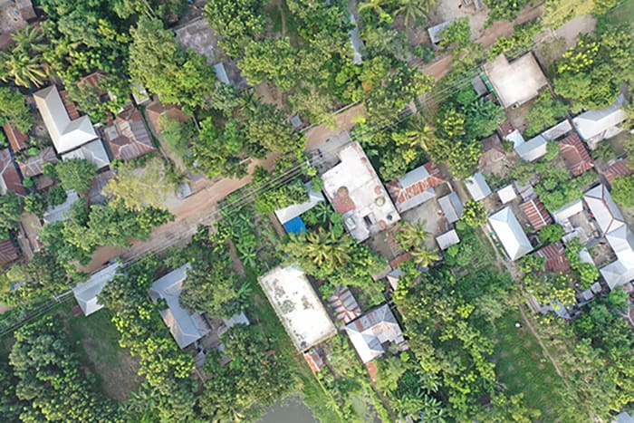
The GIS that NRECA International is developing will create an interactive database of the electric distribution system, which serves about 1.5 million consumers through 65 substations and more than 9,000 miles of electric line. The drones will capture images of the distribution system, houses, farms and commercial buildings served by the utility.
A GIS will not only show where distribution infrastructure and consumers are located, it will store detailed data such as pole size, date of purchase, date of installation and condition.
The goal of the two-year project is to provide NESCO with a comprehensive GIS network management system. That will help the utility analyze its performance to operate more efficiently, improve its financial situation, and monitor and enhance the quality of service to raise customer satisfaction, said ATM Selim, NRECA International’s team leader on the project.
NESCO is renovating and expanding its existing distribution system, he said.
“The use of drone technology will ensure the completeness and correctness of the GIS data that will be collected as a part of the project,” Selim said. “NESCO will be able to operate its business more effectively with the help of the database. This will help to improve the service quality for its customers.”
NRECA International hired drone operators, which deployed the 2-pound drones on June 19. They have been able to capture images of about 35 square miles during a four-week period.
There have been major challenges along the way, including a countrywide lockdown in June and July due to the rapid spread of COVID-19, heavy rainfall and restricted flyover zones. However, Selim said the team expects to finish its drone work after four additional weeks.
“The images are in excellent condition and are playing a very important role in the survey of electric poles and in identifying buildings in the area,” he said. The drones have also helped speed up data collection.
Without drones, data is typically collected in the field using GPS satellite technology to build digital maps. Information can also be gathered from traditional photographs, books, newspapers and government publications and databases.
“The team is always looking for more inventive ways to collect better data that can help them provide more accurate analyses and information to help our partners in different countries,” said Dan Waddle, senior vice president of NRECA International, which does GIS work in several nations across the globe. “We will use this new drone experience in Bangladesh to determine whether drones could be used effectively in other countries.”
Erin Kelly is a staff writer for NRECA.


