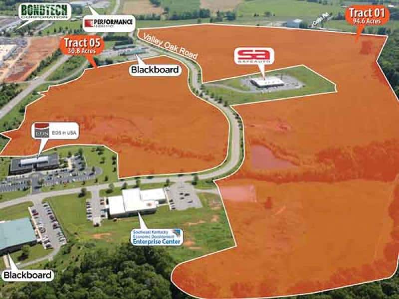
Confronted with daunting challenges in drawing employers to rural areas, Kentucky’s Touchstone Energy Cooperatives called in some high-tech air support in the form of aerial drones.
Those drones are used to capture video fly-by footage of prospective commercial/industrial sites. They also use high-tech tools to precisely map the topography, landmarks and boundaries of the sites.
The resulting data-rich videos quickly provide valuable information to site selectors who help companies and industries find ideal locations to build new facilities.
“We are using high-tech tools to take the site to the selectors virtually, providing detailed data about the site,” said Rodney Hitch, economic development manager for Kentucky’s Touchstone Energy Cooperatives. “We can even show them a computer-generated flyover of what the site could look like with their facility located there.”
The co-ops have developed videos for 17 sites in Kentucky, so far, with more to come in the future. The videos are available at www.DataIsPower.org or through the PowerMap app.
The videos also are provided to economic developers around the state and are linked to community profiles on StateBook, a leading online platform with a searchable database used by many site selectors.
And it has already paid off. One site-selection professional presented a video of an industrial site in rural Kentucky to the client in Asia, clenching the deal for the Bluegrass State.
The initiative, dubbed PowerVision, is revolutionizing the way rural economic developers pitch sites for commercial and industrial developments.
It is often challenging to coax site selectors away from large cities, especially to locations several hours from airports. But rural Kentucky often has exactly what those site selectors are looking for: low-cost land, access to transportation networks, competitive utility rates and a trained workforce.
It is often challenging to coax site selectors away from large cities, especially to locations several hours from airports. But rural Kentucky often has exactly what those site selectors are looking for: low-cost land, access to transportation networks, competitive utility rates and a trained workforce.
A year ago, economic development experts for Kentucky’s Touchstone Energy Cooperatives brainstormed ways to help rural Kentucky stand out from the crowd.
“We were already making vast improvements in the way we use data and technology to showcase rural Kentucky, with our partnership with StateBook and development of the PowerMap app,” said Brad Thomas, associate manager of economic development for Kentucky’s Touchstone Energy Cooperatives. “PowerVision builds on both of those efforts.”
With assistance from Kentucky’s Touchstone Energy Cooperatives, Statebook now features profiles of all 87 counties served by the co-ops. And PowerMap is a powerful tool that provides precise GPS mapping of co-ops’ electric service territories that brings all this technology to the palm of your hand.
The addition of the PowerVision videos provides richly textured information, helping ensure prospective industries are comfortable they are making the right investment decision.
“We are helping our communities make the very best impression they can, because it means jobs and investment for Kentucky,” Hitch said. More information: To see videos produced for PowerVision and to learn more about the economic development efforts of Kentucky’s Touchstone Energy Cooperatives, visit www.DataIsPower.org or download PowerMap from the iTunes or Google Play stores on your mobile device.
photo: The Lane Report

